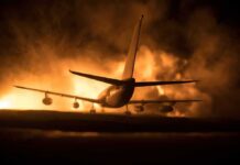

France’s wildfires have produced a rare fire cloud that can make a bad blaze far more dangerous.
Story Snapshot
- French officials and multiple outlets say the cloud is a pyrocumulonimbus, also called a fire cloud.
- The cloud forms when extreme fire heat lifts smoke, moisture, and hot air high into the sky.
- Sources say it can create its own winds, lightning, and new ignitions.
- Reporters describe the phenomenon as new or unprecedented in France.
What A Fire Cloud Is
Fire clouds are not ordinary smoke plumes. They are thunderstorms born from intense wildfires, known in science as pyrocumulonimbus clouds. France 24 says these clouds are created by extreme wildfires and can worsen already dangerous conditions. The basic process is simple: fire heats air near the ground, that air rises fast, cools, and forms a towering cloud. NASA-linked explanations in the research package describe the same chain.
That matters because the cloud is not just a sign of a big fire. It can become part of the fire’s engine. Sources say the plume can pull in stronger air, create its own winds, and carry embers farther than normal. Some reports also say lightning inside the cloud can spark fresh fires away from the main blaze. That makes the event harder to predict and harder to fight.
Why The France Event Stood Out
The France wildfire near Bordeaux and Gironde drew attention because officials and outlets described the cloud as unusual or even unprecedented there. The National Firefighters Federation of France said the giant blaze had generated a pyrocumulonimbus never before seen in the country. Le Monde quoted the local prefect describing a firestorm that mixed fire and storm behavior, with lightning and winds helping spread the flames. BBC reporting also called it unprecedented.
Those details help explain why the story spread fast. Wildfire experts have long warned that these clouds are rare, but real, in extreme fire conditions. The available research shows the same pattern in France: a large fire, unstable weather, and a plume strong enough to act like a storm. The reports do not provide a full meteorological case file, so the exact cloud depth and internal structure are not shown in the package.
What It Means For Firefighting And Public Risk
The main danger is that a fire cloud can turn one wildfire into several. The research says the cloud can generate lightning, dry winds, and spot fires. That raises the risk for firefighters and nearby towns because the blaze may jump beyond the original burn area. One report says embers were carried farther afield as the local convection column intensified. That is a serious problem in areas with heavy forest fuel and shifting winds.
France continues to fight against wildfires being stoked by an unprecedented 'pyrocumulonimbus' or fire clouds.
Atmospheric science professor James Heywood explains the fire-generated phenomenon. pic.twitter.com/hxxE8hArT9
— BBC Radio 4 PM (@BBCPM) July 27, 2026
The broader lesson is less about one headline and more about the kind of risk modern fire seasons now create. The sources connect pyrocumulonimbus clouds to extreme heat, dry conditions, and violent fire behavior. They also show how public language can blur the line between smoke, pyrocumulus, and a full thunderstorm-like fire cloud. In France, that distinction matters because the cloud itself can help drive the next wave of damage.
Sources:
insiderpaper.com, nytimes.com, bbc.com, itv.com, lemonde.fr, sfgate.com, france24.com, today.rtl.lu, wionews.com, livemint.com, bnnvara.nl, news.cgtn.com, sciencesetavenir.fr, youtube.com, science.howstuffworks.com, wcrp-climate.org, nature.com, theguardian.com, en.wikipedia.org, paucostafoundation.org, innovate.research.ufl.edu, nationalgeographic.com, independent.co.uk, cnn.com, scientificamerican.com, rmets.org, bom.gov.au, geographyrealm.com, science.nasa.gov, facebook.com
© patriotsunited.org 2026. All rights reserved.